Curator Billy Tang talks with the Geocinema collective (Solveig Suess & Asia Bazdyrieva) about the sensory networks that represent the Earth on a planetary scale and their relationship with a geopolitical reconfiguration of the world in the face of the climate crisis around the international cooperation project Digital Belt and Road (DBAR).

Geocinema (aka Solveig Suess & Asia Bazdyrieva) is a collective that explores the possibilities of a “planetary” notion of cinema. The surface of the planet is documented in ever-greater detail by the increasing proliferation of images captured by individuals and technologies today, and by the collection of data on different scales. Geocinema’s research reflects both the architecture and infrastructure behind this network, which to it constitutes a decentralized moving-image apparatus. It also engages with the intersection between corporations and governments that feed into and extract from this widely dispersed network of footage. In addition to the political implications of surveillance—from an individual, global, and astronomical perspective—it is also interested in how this vast constellation of visual, auditory, and geographic data is increasingly utilized to predict the future. Throughout its practice, tensions are revealed between the relationships of the totalizing and fragmented, disembodied and situated, as well as past and present-futures.
Billy Tang (BT): Intersections with other fields of study and engaging different areas of society have been important to you both. How is this related to the historical evolution of cinema as the name of your collective and project suggests?
Asia Bazdyrieva (AB): The initial concept of Geocinema was to consider planetary-scale networks of data accumulation as a vast cinematic apparatus, a camera. Here the notion of an image in relation to recording devices has already expanded and become embedded in geological formations as much as it has within sociopolitical configurations. We are directly borrowing from the idea of montage when we speak of earth’s representation as never being one holistic entity. Our interest and connection to cinema refer to the technique of mediating space and time, which creates a potent feedback system, and it creates a particular form of agency as it loops between our optical nerves and sensory experiences via moving images. In the twentieth century, with the huge development in optical devices, moving images can be instrumentalized as objectifying tools as well as being emancipatory. It is because of this that we are keen to tackle the underlying biases existing in optical regimes and to begin thinking about alternatives to them. So far, we have organized our work around “episodes”, which explore various aspects of imaging and cinematic perception.
Solveig Suess (SS): A lot of our work has been about connecting more contemporary starting points and case studies to a longer lineage of photography and image cultures. Take, for example, images meant only to be read by machines (such as self-driving cars), read by staff to check the quality of products on an assembly line, or all the things logged while crossing security checkpoints. These images are used for operations that range from science and measurement to the control of capital and labor. This overabundance of recording, archiving, and distribution is absolutely overwhelming in its quantity and scale. And it flags up many questions related to how we understand time, but also our cognitive abilities to critically reflect on these processes and their effects.

Of course, the development of cinema and film-making has always been entangled with new optics and recording methods developed not only for the purposes of the film industry but also for science and the military. So, for us, the project of Geocinema is both a method to understand how these images perform within their environment, but also the extent that the environment itself structures images and how they are able to circulate.[1] We wanted to address places that feel closer to our own histories or political stakes, whether in China, Ukraine, or beyond. To lean on the media theorist Ute Holl, she speaks of how “the cinematic” circles and withdraws back into the subroutines of the mind, the apparatus, the industry, and the landscape. “Cinema” as a collective experience of entrancement in a shared space.
BT: Are there any methods or tools you regularly rely on? This might be related to how you might undertake fieldwork or, in a general sense, related to a wider strategy that allows you to work across different scales, but also the geographies that you mention.
SS: It’s important to mention Geocinema also as a method. Because we want to directly struggle with the challenges of representation within these large and often very abstract processes: filmmaking is then important for us both as a tool, but also as a mode of research.
AB: This challenge of representation is the reason behind our overt infrastructural take on research and filming. Most of the imaging techniques today are not immediately visible or perceivable by humans—they are too complex, dispersed, or too fast. At the same time, we are governed by images and algorithms that mobilize and organize our perception, which is preprogrammed on many levels.
How to represent complex systems and mechanisms, which are not immediately perceivable by themselves?
Our approach to dealing with this difficulty is engaging infrastructures related to sensing and imaging techniques, and we do this by entering various spaces that we regard as constituting the architecture of planetary-scale cinematic processes. This infrastructural take defines our method of initiating fieldwork—we physically follow the generation of an image. This allows us to borrow from various fields of inquiry, such as critical theory, feminist epistemology, radical geography, and media theory.

SS: What we appreciate with documentary film is the focus on its process. We then can circulate back towards thinking about larger, grander questions around modernity, cinema, aesthetics, and epistemology. We literally use a camera to record our encounters and conversation, this happens all throughout the process in terms of our collaborations with others related to sound, moving images, and text. So, we go through the process of listening and reviewing, editing, and discussing in order to process through all these scenes, architectures, conversations, and affects. We often refer to a feminist politics of reworking signal and codes through audio-visual material, which often can emerge through the stitching and unstitching across different temporalities and spatial distances, no matter however grand or modest they are—often in our case, it is mostly the latter.
BT: Could you tell me more about the concept of the new project you are working on?
AB: Framing Territories is one part of a series of episodes of Geocinema and it explores the relationship between Earth-imaging and terraformation. We were interested in how optical regimes of looking at the earth feed into practices of material extraction that eventually turn into larger phenomena such as global warming. We then knew about the Digital Belt and Road (DBAR) project, which is the digital counterpart to the One Belt One Road initiative. Although established by the Chinese government, it also hybrid and internationalized. The DBAR project aims to design an international platform to aggregate earth observation data in order to prevent risks related to climate change. So, actually, it is about having more information about the earth in order to help extract or develop from it, while also alerting and raising awareness of any potential risks involved in this process, thereby enabling organizations to make preemptive decisions in response. Therefore, it is a strange situation, where something made to prevent climate change is actually also the cause of it in the first place. We were fascinated with how notions of global conservation could simultaneously emerge alongside processes related to its exploitation.
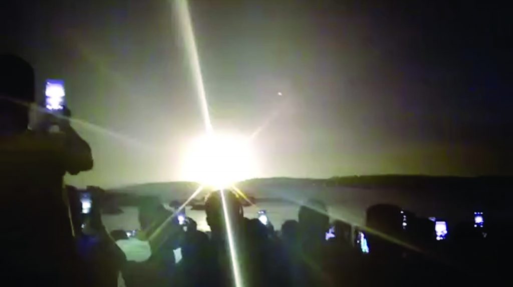
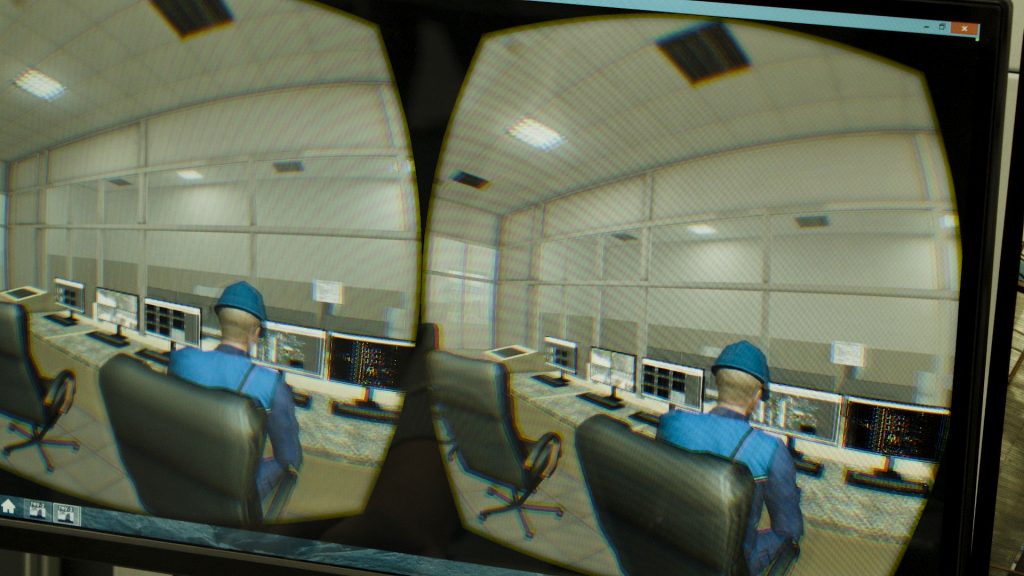
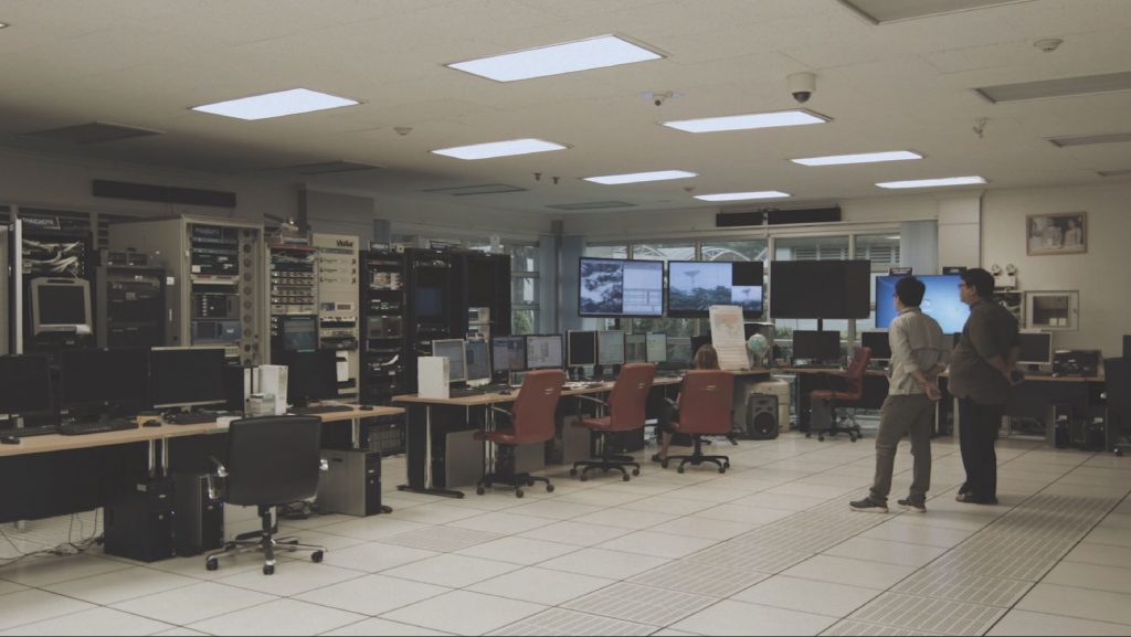
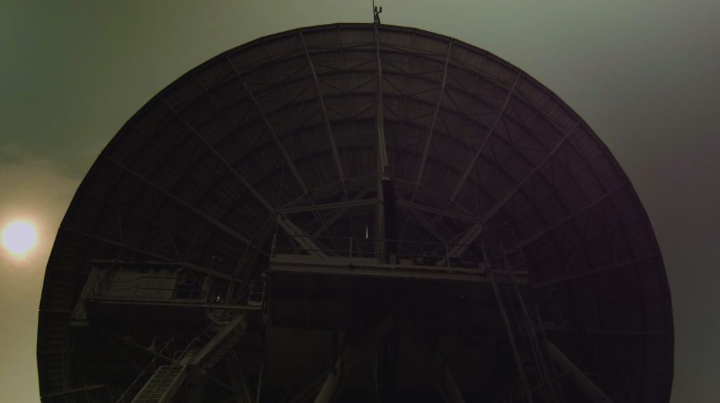
SS: Under this episode, we are currently working on a short film Making of Earths, which is one of the distillations that emerged from this research. With the film, we literally begin in a cinema-globe, which sits at the center of the Chinese Academy of Sciences campus. This is the cinema-globe that the institute uses for official meetings or PR reasons, where we were led during a tour to watch a 3D trailer of the Digital Belt and Road project. Our film then expands from this scene out to the distributed operations of this vast network. Following this, we then included places such as the satellite ground station of Miyun and Tengchong, where DBAR hosted their third conference; Sri Racha, where the ground station in Thailand is based; a climate research center in Bangkok; and the offices for risk management within Gaz- prom’s technopark in Omsk, Russia.
BT: Transnational entities, and particularly conferences, seem to play an important role as “access points” into the re- search. Can you tell us about your experiences with this?
SS: One of the initial key places we traveled to after the Chinese Academy of Sciences in Beijing was the 3rd Digital Belt and Road Conference in Tengchong. Before we went there, we had sent requests to the Chinese Academy of Science, which included our interest in accessing one of their satellite ground-stations to film, including Miyun near Beijing. We requested to attend the conference as filmmakers working on the topic of the climate crisis and its representation. For both locations, we had our requests denied, but nevertheless, we still tried to show up to them. The conference had an impressive entrance fee, but through the help of a friend, Asia managed to purchase a ticket and attend the conference.
AB: Events such as the DBAR Conference are interesting as a genre of official and overly ceremonial ways of communicating geopolitical issues. They are also rather sad events, where urgent matters such as climate change are often completely depoliticized. While the environmentally green rhetoric was prominent throughout the conference, the main focus was on how scientific advancements could be utilized towards further development of the nation-states.
BT: I was wondering how in the last few years, this research connects to issues of surveillance—particularly as the field research has now taken you from China into places such as Thailand?
SS: As soon as we enter the Chinese Academy of Sciences in the film, we get introduced to Professor Li, the head of the Big Data working group within the DBAR program. He was diplomatic and generous with how much he shared with us in terms of the rhetoric of DBAR and why it is important for them. One of the things that stuck with us throughout was when he described the basics of a satellite image. A picture contains thousands of pixels, but there is obviously no inherent meaning in a pixel. In his words, when data is translated into information, information can be seen as an object, an object that is defined by a series of material relations. Data is not water, but water is defined through characteristics such as its age, its clearance, its reflections. The same goes for forests, whether natural or manmade. Here, the algorithm is not limited to the actual code, which precedes the satellite image, but continues in the way that the institution then mobilizes and turns this knowledge into policies. This has implications related to the realm of resource extraction, largescale infrastructure plans, and ecological management such as the Three-North Shelter Forest Program, or more commonly known as the Great Green Wall. So, the film moves through spaces that shape the emerging architectures of earth-imaging and glides across the massive infrastructural projects of the Belt and Road. There are moments that remind the viewer of the constant recording that is happening across different environments throughout the entire film. But we also wanted to show that these operations do much more than simply render visible different versions of the Earth.
AB: Surveillance is often associated with ideas of direct control or militaristic notions of visibility connected to the relationship of boundaries and power. However, the ever-expanding data economy brings forth new forms of surveillance and governance, which are extremely hard to locate, because they are no longer centered on “traditional” power hierarchies. In the film, Alexandre Caldas, a UN Environment representative, and keynote speaker at the DBAR conference notes that the value of any country is its territory, yet we no longer need to physically invade a territory in order to extract its resources. Warfare is now operated through investment and data, but we also begin to explore the connection of these issues through infrastructure.
So, to elaborate on what Solveig said, in defining dominant knowledge practices, those in the positions of power are able to dictate the rationale behind various modes of operation. Take for example DBAR. One of the project’s main ambitions is to support the assembly and distribution of scientific data and knowledge to so-called “data-poor” countries. For example, it might be countries such as Bangladesh or Cambodia. This is simultaneously being agreed on in exchange for infrastructure projects such as fiber-optic cables, which are being laid under the conditions outlined by the Chinese state. These countries cannot afford their own infrastructure and cannot afford to produce knowledge from their own locales, therefore they are becoming defined by an external and often colonial gaze. Last but not least, surveillance is more oblique when it comes to how we consume moving images on our individual screens. Data-harvesting algorithms are used to develop products and this feeds back into manipulating the things we want before we even know it.
BT: Related to Alexandre Caldas, he describes some future scenarios connected to infrastructure projects such as the DBAR. Could you talk more about the implications behind the projections hypothesized by these speculative scenarios in relation to China?
AB: Caldas started off with the current geopolitical model of the United Nations, which embodied the postwar ideal of peaceful collaboration between nations. Current crises, from wars to ecological crises, demonstrate that this model is no longer working. In our conversation, he was speculating on potential scenarios related to the emergence of new superpowers like those of the Cold War era, unions similar to the EU and ASEAN, or the development of other spheres of influence as he called them. The Belt and Road is just one example among a number of extensions of influence.
We cannot use the word territory anymore, because this includes data, which is invisible and is not territorial.
This of course echoes ear-lier remarks on migrating the technology of governance. The Belt and Road Initiative is an outstanding example of how this governance takes shape as an international infrastructure enabler. At the same time, its concept is a continuation of a modernist ideal of synchronization, speed, and progress.
SS: Right, a project operating through the desire for connection within a world full of data, just waiting to be captured.
AB: There are emerging mechanisms to exploit this abundance. For example, there is a team in the Chinese Academy of Sciences that works on algorithms that process natural languages sourced from social media within China. When certain words become used more often, this triggers a response mechanism. So, when a flood is happening, people talk and will post about it much earlier and more broadly, compared to the information released by any state agency. The development of such techniques becomes justified as a protection against the devastating powers of a natural disaster. The government wants to know more for your safety. Yet there is a dangerous twist we also have observed through the seemingly noble logic of care and protection related to the current pandemic response.
The alienation of a natural disaster or virus is used to justify new forms of surveillance that aid preemptive forms of policing.
SS: There is a brief moment in the film of a view from the window of a moving car, where you see a massive new railway station under construction in Bangkok, which will be the hub for a high-speed rail network spanning South East Asia. The railway cuts straight through Thailand’s northern forests up into Laos, and then into Kunming in China, where ecological laws protecting the forests have been suspended for the duration of its construction. Seemingly, the neutral rhetoric of efficiency related to data usage misses this complex reality, because it also obscures many of its dangerous consequences by rationalizing such side-effects as acceptable in the name of progress.
BT: There is a director you speak to in Thailand, who seems to embody this romantic idealization of how information and data can be utilized. She speaks about the difficulties in terms of finding meaningful ways to utilize and standardize the capture of data in the region.
AB: DBAR is interesting as it amplifies the modernist utopia of synchronization and speed. Starting with early nineteenth-century databases through to the International Geophysical Year in the mid-twentieth century, these utopias bring forth the idea of standardization as an ultimate civilizational tool. This is exactly the rhetoric deployed by DBAR. When we saw the 3D film at the Chinese Academy of Sciences, Al Gore’s hologrammed head appeared and started talking about the challenges of climate change. During the 1990s, it was Gore who coined the idea of the Digital Earth, a multifunctional model of the globe using vast amounts of georeferenced data embedded within it. The idea is to maximize the information we can attain related to what is happening on the earth. If an unwanted event occurs, this gives you the ability to preemptively anticipate things. However, as we mentioned earlier, the underlying logic is that economic growth is prioritized at the forefront of everything, which then causes the instrumentalization of these planetary surveillance systems. So, this ecological mambo jumbo is a convenient way to shift scientific rhetoric into a technocratic one. These grand projects rarely run smoothly, instead, they are filled with failed attempts and awkwardness as we show throughout the film.

BT: You mentioned the concept of Digital Earths in an essay for e-flux. How does this concept relate to the role of subjectivity in your practice? In other words, in the films, do you look to maintain a neutral voice throughout and how do you position yourself in relationship to the contentious issues you find?
AB: We are rather critical of the omnipresent depoliticization of environmental rhetoric and visuality. The holistic or singular image of the earth embodies this depoliticization as it stems out from a particular logic of a Nature/Culture divide and a universalized notion of humanity that is now presented as being responsible for the crisis. The current crisis demands political reconfigurations that start with the recognition of systemic violence against a certain group of people or a specific natural locale. When we speak of Geocinema as an assemblage, we are keen to find a frame to speak with all the various levels of how images or representation form, as well as to discover what agency is possible within that. The emphasis on multiple Earths comes from the cinematic idea of the montage, which inspired us to productively oppose the projection of totality by actively looking for configurations that resist this concept.
SS: The works we produce are far from neutral. But I don’t think we’d ever want to be hegemonic in dictating the viewer’s experience. We would rather like to lay down a few coordinates for the viewer to experience and question this topic on their own terms.
–
This interview was originally published in English in LEAP magazine F/W 2020.


Comments
There are no coments available.